地圖學
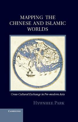
Mapping the Chinese and Islamic Worlds 豆瓣
作者: Hyunhee Park Cambridge University Press 2012 - 8
Long before Vasco da Gama rounded the Cape of Good Hope en route to India, the peoples of Africa, the Middle East, and Asia engaged in vigorous cross-cultural exchanges across the Indian Ocean. This book focuses on the years 700 to 1500, a period when powerful dynasties governed both regions, to document the relationship between the Islamic and Chinese worlds before the arrival of the Europeans. Through a close analysis of the maps, geographic accounts, and travelogues compiled by both Chinese and Islamic writers, the book traces the development of major contacts between people in China and the Islamic world and explores their interactions on matters as varied as diplomacy, commerce, mutual understanding, world geography, navigation, shipbuilding, and scientific exploration. When the Mongols ruled both China and Iran in the thirteenth and fourteenth centuries, their geographic understanding of each other's society increased markedly. This rich, engaging, and pioneering study offers glimpses into the worlds of Asian geographers and mapmakers, whose accumulated wisdom underpinned the celebrated voyages of European explorers like Vasco da Gama.
London 豆瓣
作者: Robert Batchelor University of Chicago Press 2014 - 2
If one had looked for a potential global city in Europe in the 1540s, the most likely candidate would have been Antwerp, which had emerged as the center of the German and Spanish silver exchange as well as the Portuguese spice and Spanish sugar trades. It almost certainly would not have been London, an unassuming hub of the wool and cloth trade with a population of around 75,000, still trying to recover from the onslaught of the Black Plague. But by 1700 London’s population had reached a staggering 575,000—and it had developed its first global corporations, as well as relationships with non-European societies outside the Mediterranean. What happened in the span of a century and half? And how exactly did London transform itself into a global city?
London’s success, Robert K. Batchelor argues, lies not just with the well-documented rise of Atlantic settlements, markets, and economies. Using his discovery of a network of Chinese merchant shipping routes on John Selden’s map of China as his jumping-off point, Batchelor reveals how London also flourished because of its many encounters, engagements, and exchanges with East Asian trading cities. Translation plays a key role in Batchelor’s study—translation not just of books, manuscripts, and maps, but also of meaning and knowledge across cultures—and Batchelor demonstrates how translation helped London understand and adapt to global economic conditions. Looking outward at London’s global negotiations, Batchelor traces the development of its knowledge networks back to a number of foreign sources and credits particular interactions with England’s eventual political and economic autonomy from church and King.
London offers a much-needed non-Eurocentric history of London, first by bringing to light and then by synthesizing the many external factors and pieces of evidence that contributed to its rise as a global city. It will appeal to students and scholars interested in the cultural politics of translation, the relationship between merchants and sovereigns, and the cultural and historical geography of Britain and Asia.
Fra Mauro's Map of the World 豆瓣
作者: Falchetta, Piero/ Zorzi, Marino (CON)/ Balletti, Caterina (CON) Brepols 2006
ra Mauro’s map of the world – a masterpiece of western cartography, composed around 1450 – has until now never been the subject of a modern study, despite its immense renown. The map has been reproduced and cited in hundreds of books, but the most recent full study was in 1806: Placido Zurla’s Il mappamondo di Fra Mauro. The present book aims at an analysis and an in-depth study of this important document, offering the reader an understanding within its contemporary cultural framework.
The project is the result of collaboration between historians and scholars belonging to two Venetian institutions, the Biblioteca Nazionale Marciana – where the map is still preserved – and the Centro Interdisciplinare di Rilievo, Cartografia ed Elaborazione (CIRCE) of Venice's Iuav University. The work is in two parts, a volume of studies and a CD-ROM. The latter contains not only a high-resolution image of the map, but also software for cross consultation of text and image, in order to allow 'navigation' between the map and its inscriptions
Piero Falchetta is curator of maps at the Marciana National Library in Venice.